
Walk an Osceola County Street
A reliable Osceola County street directory begins with a single valid address, then expands one parcel at a time. Ownership is the firmest public fact. Occupancy takes more care because the tax roll names owners, not every person at a home. Save each parcel number, legal description, and source date as the search moves. Those stable details prevent a similar street name or owner name from pulling the work onto the wrong property.
- Normalize the address, while keeping every old spelling or number found in family papers.
- Use the Osceola County Property Appraiser search to capture the owner, situs address, mailing address, parcel ID, subdivision, legal description, exemptions, improvements, sales, and deed references.
- Open the parcel map and click adjoining polygons. Record the parcel IDs on both sides of the road instead of relying on map labels alone.
- Follow each deed reference into the Clerk's official-record system. Read the instrument when available because an index can shorten a trust name or omit a spouse.
- For lawful historical work, compare directories, census schedules, permits, and a properly released voter file. Each source covers a different group.
This sequence turns a road into a set of documented parcels. It does not turn ownership into proof of residence. A second roll or dated document should support any claim about who lived at an address.
Search Osceola Streets by Address
The Property Appraiser is the key street-by-street source because its live roll accepts several ways into the same parcel. Search broad first, then narrow. Directional prefixes, unit labels, and the difference between “St. Cloud” and “Saint Cloud” can change a match. Owners that are trusts or companies should be searched exactly as the parcel card displays them.
| Search choice | Input style | Best street-directory use |
|---|---|---|
| Owner name | Person, trust, or entity | Find other parcels tied to the same displayed owner |
| Property address | House number and street | Open the known site or browse similar road matches |
| Parcel ID | County parcel identifier | Return to one exact property without a name guess |
| Subdivision | Recorded subdivision name | Group lots where street labels are weak |
| Map location | Interactive parcel selection | Move to adjacent lots on both sides of a block |
The live parcel card commonly supplies the assessed owner, mailing and situs addresses, legal description, values, exemption indicators, building data, sales, and deed references. These fields give an Osceola County street directory a documented base instead of an inferred list.
The main property-search form shows how the county separates those routes.
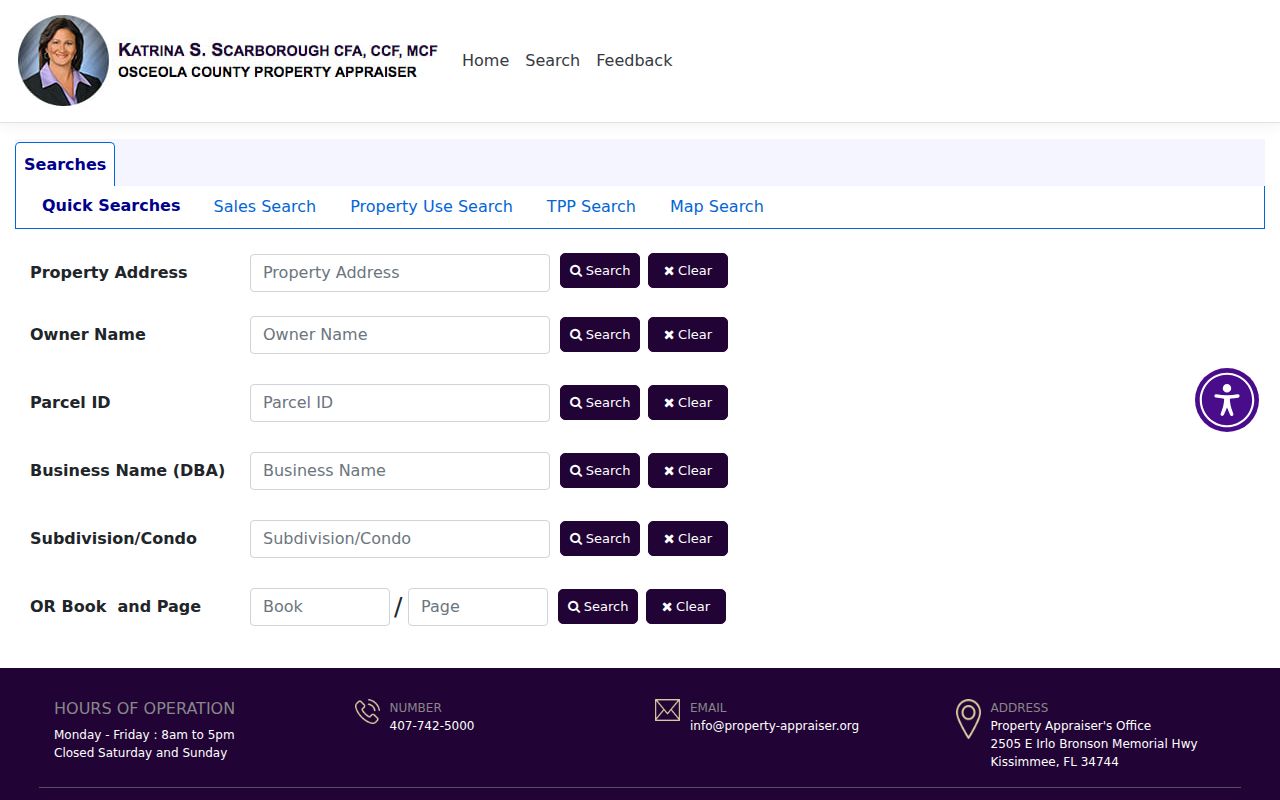
The form is useful because the same road can be approached through its address, subdivision, owner, or parcel identifier.
Osceola County Address Record Set
No single county file is a full street directory. The sources below answer separate questions and have separate keepers. The parcel ID and legal description are the best links among them.
| Address source | Custodian | Evidence available | Access route |
|---|---|---|---|
| Parcel and tax roll | Osceola County Property Appraiser | Owner, mailing and situs addresses, exemptions, sales, improvements | Free live search and downloads |
| Parcel and county GIS | Property Appraiser and County GIS | Parcel shapes, nearby lots, zoning, flood and district layers | Interactive viewers |
| Deeds, liens, mortgages, and plats | Osceola County Clerk | Named parties, legal description, instrument date, book and page | PERCH, historical index, request, or counter |
| Permits and code files | City or county development office | Applicant, contractor, parcel, project and inspection dates | Portal where indexed, request otherwise |
| Released voter file | Vote Osceola | Public registration fields subject to redaction | Public-record request |
| Historical directories | Libraries and archives | Annual name, occupation, spouse notation, and sometimes address order | Catalog, licensed database, or research request |
County records cover incorporated and unincorporated land, but permits do not. Kissimmee, St. Cloud, and Osceola County keep their own local development files. Determine jurisdiction before requesting an address record.
Two Osceola County Addresses
A parcel card can show both a situs address and an owner mailing address. Situs means the physical location of the land. Mailing is where assessment notices go. It may point to the parcel, another home, a post office box, a business, a trustee, or a manager. Matching addresses plus a homestead indicator can support an owner-occupancy theory, but neither fact proves that the owner is present now.
- Parcel
- A mapped unit of land with its own county identifier.
- Situs address
- The physical address assigned to the parcel, when one exists.
- Plat
- A recorded map that divides land into named subdivisions, blocks, and lots.
- Criss-cross directory
- A directory arranged by street or address rather than only by a person's surname.
Absentee ownership is common in tourism and short-term-rental areas. Condominium complexes may also place many parcel owners behind one building label. The street directory should preserve unit and parcel distinctions instead of treating the complex as one household.
The Property Appraiser data page provides certified final-roll data and free absentee-owner lists, including versions with building or sales data.
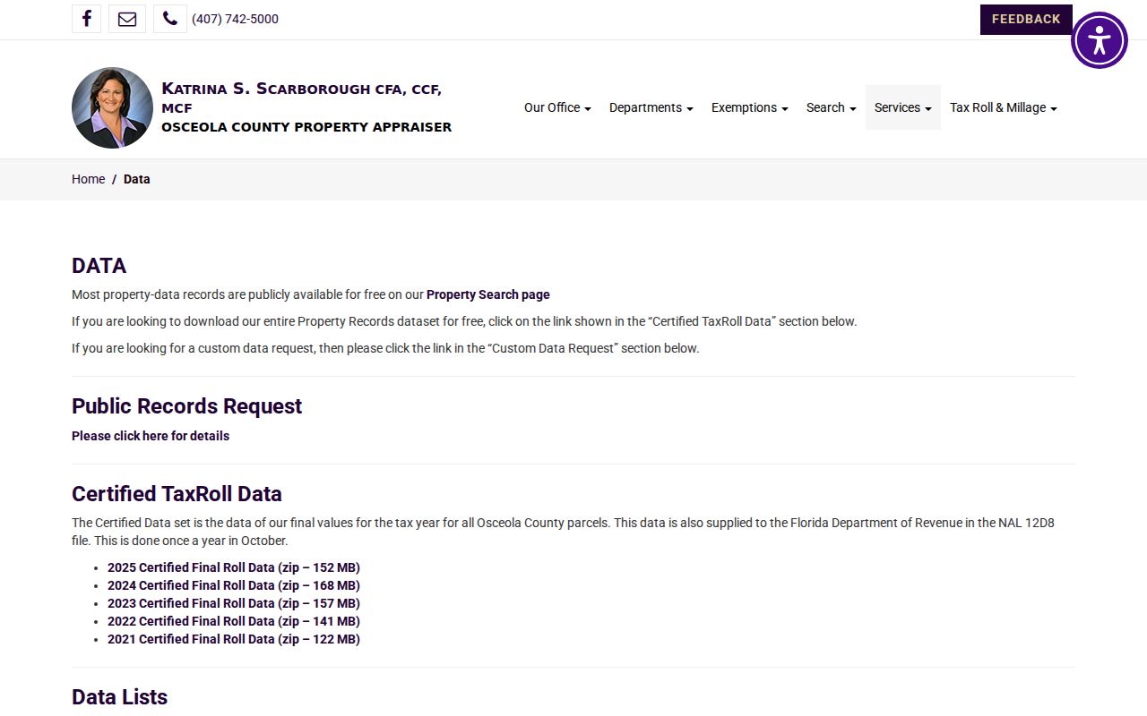
Those bulk files help compare mailing and situs patterns without suggesting that every listed owner occupies the parcel.
Follow Osceola Streets into Deeds
The Clerk's recorded instruments add the ownership transaction behind the tax-roll headline. Search the current owner's deed reference, then match the legal description. A grantor transfers an interest; a grantee receives it. Mortgages, satisfactions, liens, judgments, and plats can add context, but only the actual image explains what an indexed name was doing in the record.
Older deeds may omit the modern street address. Carry the lot, block, subdivision, section-township-range, or metes-and-bounds wording backward. In rural Kenansville and southern Osceola County, section-township-range can be much stronger than a road label. In platted Kissimmee or St. Cloud growth, lot and block usually provide the better bridge.
The Clerk's recording and copy FAQ explains deed, plat, and copy routes.
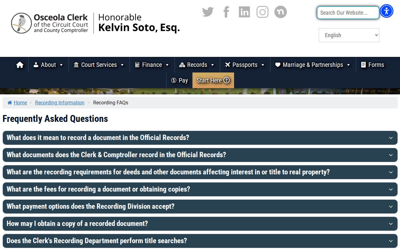
The page confirms why the street search must move from a free index to the underlying recorded item when exact title evidence matters.
Note: The historical index can locate book and page, while the underlying image may require an email request to the Clerk.
Map Osceola County Street Jurisdiction
A Kissimmee mailing name does not guarantee that an address is inside incorporated Kissimmee. St. Cloud postal names can also extend beyond city limits, and Poinciana reaches into the Osceola and Polk context. Four Corners is multi-county by nature. Before looking for a permit, code case, or local administrative record, confirm the parcel's county and municipality flag.
The Osceola County maps and GIS hub adds zoning, flood, commission, and service-district context. The county GIS office also supports mapping questions. Its published hours differ on Friday from the Monday through Thursday schedule, so check current office details before a visit.
Postal geography, municipal authority, and parcel geography solve different problems. USPS standardizes delivery. The property map identifies land. A city-limit or county layer identifies the office that should hold permits and code files.
Local form also changes the method. Downtown Kissimmee may show small platted lots that can be compared with early maps. Celebration, Reunion, and other planned communities can include association land, condominium declarations, and owners whose mail goes outside Osceola County. Narcoossee, Harmony, and Kenansville can require acreage or section-township-range work. In Poinciana, confirming the county line comes before choosing a clerk or property appraiser. A street-directory result is strongest when it records these geographic limits beside the names.
Osceola Street Permits Add Dates
Building permits and code cases can establish when work occurred at an address and name an owner, applicant, contractor, parcel, permit type, issue date, final date, or inspection status. They do not establish a full household. County files apply to unincorporated parcels, while Kissimmee and St. Cloud maintain municipal systems for land in their limits.
Search by both address and parcel number. Save the permit or case number before asking for plans or archived inspections. No authoritative countywide online cutoff was verified, so an empty web result should lead to the relevant development-services request channel, not to a claim that no file exists.
Older Osceola County Street Labels
No verified countywide street-renumbering year was found. When an old number fails, compare the legal description, plat, cross streets, adjoining owners, historic maps, and building footprint. The free Library of Congress 1889 Kissimmee Sanborn edition has two sheets. It shows street labels, construction, use, and fire features, but it does not name occupants.
Historical directories can supply names and addresses when a specific volume has a street section. The verified local title is the 1921-22 Kissimmee and St. Cloud directory and Osceola County gazetteer. Do not assume that it contains a reverse section until the volume itself is checked. The full shelf and reading method belong on the Osceola County directory-book page.
For events before Osceola County was created in 1887, search Orange or Brevard custody according to the historic place and date. Modern boundaries can send an older street search to the wrong catalog.
Osceola Voter Files by Street
The statewide voter-status tool asks for first name, last name, date of birth, and county. It is identity-gated and is not an anonymous reverse street directory. A properly released voter file may include public address and district fields, but it must be requested from Vote Osceola with a snapshot date and desired format.
Florida Statute 97.0585 withholds Social Security, driver-license, and Florida identification numbers, registration-place data, preregistrant information, and copies of signatures. Protected addresses and occupational exemptions can remove more. Absence from a voter file never proves that nobody lives at an address because children, noncitizens, unregistered adults, and inactive or cancelled registrations can be absent.
Ask the Supervisor of Elections for the public fields needed, the file format, and the exact election or roll snapshot. A date is vital because registration status and addresses change. Vote history, when released, reports whether a ballot was cast, not how anyone voted. The individualized status form should be used only with the required identity details, while a block or street analysis belongs in a lawful public-record request.
Limits of an Osceola Street Directory
Public records can identify landowners, recorded parties, permit applicants, and some registered voters. They do not form a complete roll of renters, family members, guests, or current occupants. Homestead status is a clue, not proof. A business or trustee mailing address may be far from the parcel. A commercial compilation may also merge old and current data, so confirm each useful lead with its official custodian.
Lawful use. Use Osceola County address records only for legitimate personal research. Never use a street directory to stalk, harass, intimidate, or harm anyone.
The strongest conclusion is narrow and dated: a named public source showed a stated fact on a stated date. Keep the source, parcel ID, document number, and access date with every entry.
When sources conflict, correct the record at its custodian. A parcel-owner issue belongs with the Property Appraiser, an indexed deed issue with the Clerk, and a permit issue with the city or county office that issued it. Do not spread an unverified address claim. Recheck spelling, unit number, parcel ID, municipality, county, and effective date before deciding that two records describe the same person or property.